Helping Londoners Explore Tideway’s New Riverside Spaces
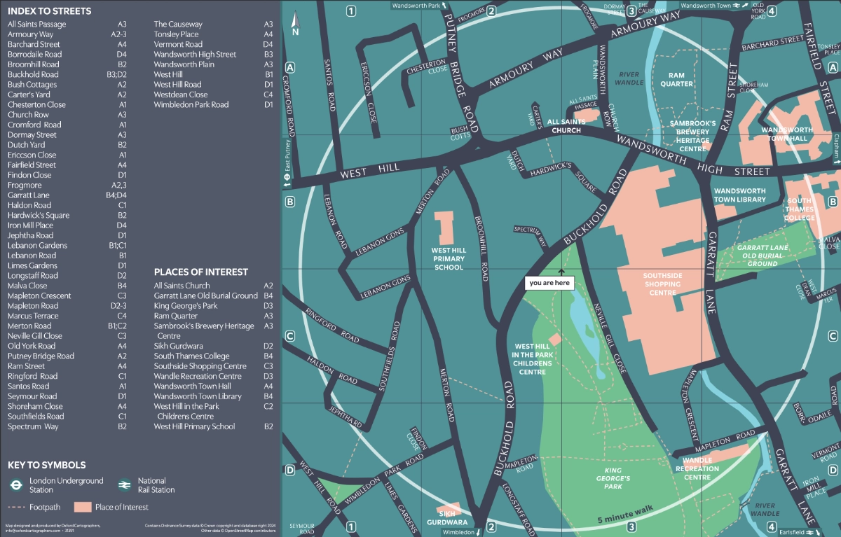
Oxford Cartographers has supported the Tideway project with a suite of clear, accessible wayfinding maps designed to help people explore the new public spaces emerging along London’s riverfront.
The Tideway scheme, often called London’s “super sewer”, is transforming the capital’s relationship with the River Thames by improving water quality and creating a series of beautifully designed open spaces for everyone to enjoy. These new areas reconnect communities with the river and celebrate the city’s industrial and cultural heritage.
Our bespoke wayfinding mapping helps visitors navigate and discover these spaces with ease, highlighting nearby transport links, walking routes, and local landmarks.
Among the new destinations already open are:
Bazalgette Embankment, located on the north bank of the Thames to the west of Blackfriars Bridge, offers sweeping riverside views and landscaped seating areas.
Putney Embankment Foreshore is a welcoming public space where the river’s edge has been thoughtfully restored.
By making these new parts of the Thames accessible and easy to explore, Oxford Cartographers’ mapping supports Tideway’s wider vision of reconnecting Londoners with their river.

New Tideway Wayfinding Scheme