FREQUENTLY ASKED QUESTIONS
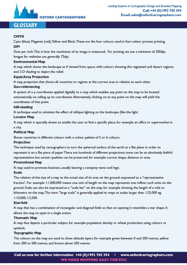
The colours on the map are used to show altitude layers, for example, green between 0 and 200 metres, yellow from 200 to 500 metres, and brown above 500 metres.
A map that depicts a particular subject, for example, population density or wheat production using colours or symbols.
A map that has a combination of rectangular and diagonal folds so that on opening it resembles a star shape. It allows the map to open in a single action.
The relation of the size of a map to the actual size of its area on the ground expressed as a “representative fraction”. For example 1:1,000,000 means one unit of length on the map represents one million such units on the ground. A scale can also be expressed as a “scale bar” on the map, for example showing the length of a mile or kilometre on the map. The term “large scale” is generally applied to maps at scales larger than 1:25,000 eg. 1:10,000; 1:2,500.
A map used to promote business, usually bearing a company name and logo.
The technique used by cartographers to turn the spherical surface of the earth to a flat plane in order to represent it on a flat piece of paper. There are hundreds of different projections; none can be an absolutely faithful representation but certain qualities can be preserved, for example, correct shape, distance or area.
Shows countries in different colours with a colour palette of 5 or 6 colours.
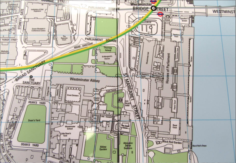
A map which is especially drawn to enable the user to find a specific place, for example, an office or supermarket in a city.
A technique used to simulate the effect of oblique lighting on the landscape (like the light)
A system of x-y coordinates applied digitally to a map which enables any point on the map to be located automatically on calling up its coordinates. Alternatively clicking onto any point on the map will yield the coordinates of that point.
A map projection that shows all countries or regions at the correct area in relation to each other.
A map which shows the landscape as if viewed from space, with colours showing the vegetated and desert regions, and 3-D shading to depict the relief.
Dots per inch. This is how the resolution of an image is measured. For printing we use a minimum of 300dpi.
Images for websites are generally 72dpi.
Cyan (blue), Magenta (red), Yellow and Black. These are the four colours used in four-colour process printing.
Download our glossary datasheet
OUR LATEST PROJECTS
OUR CORE AREAS
We can provide maps for every industry, but we have many clients that are in these business sectors:

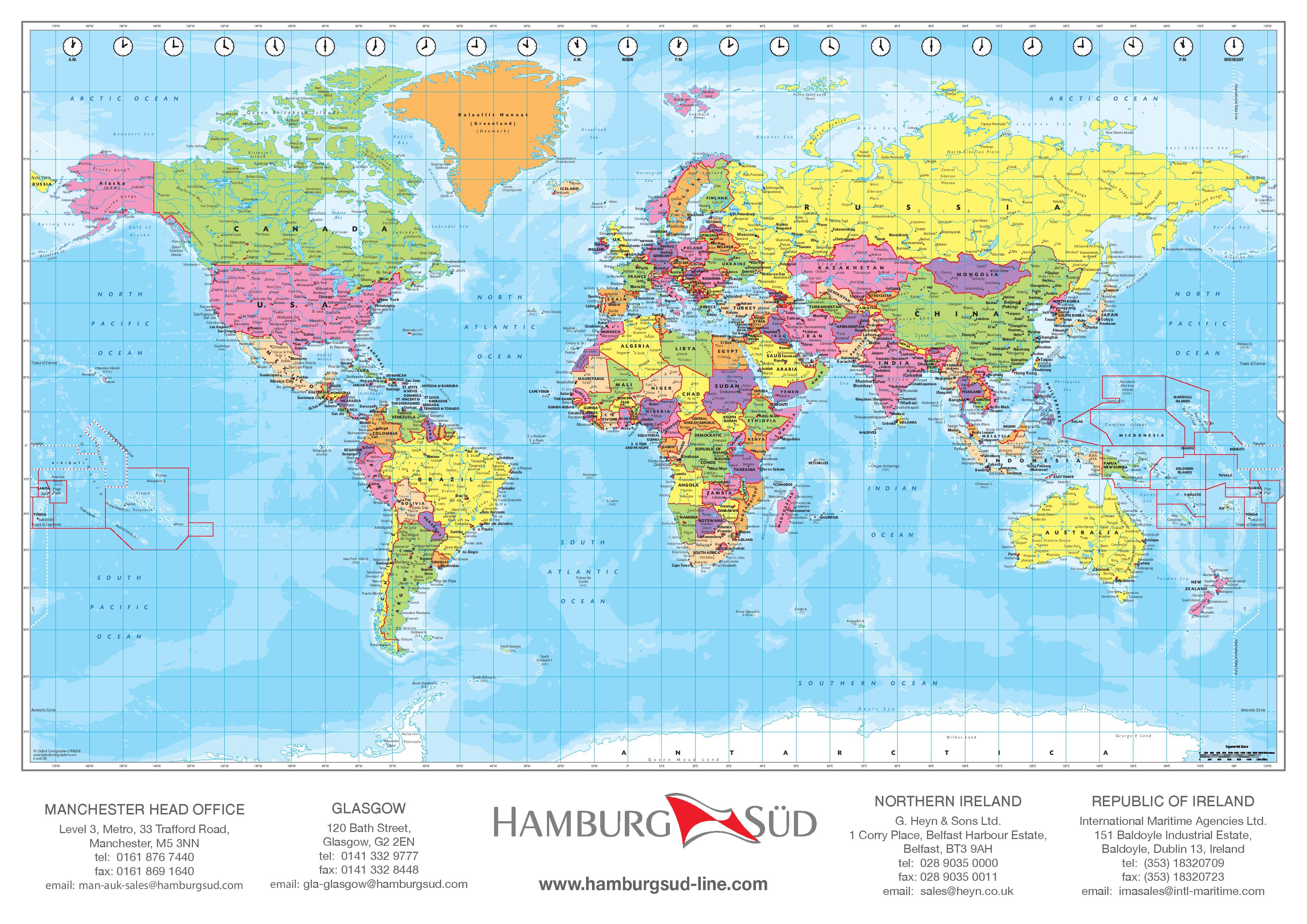
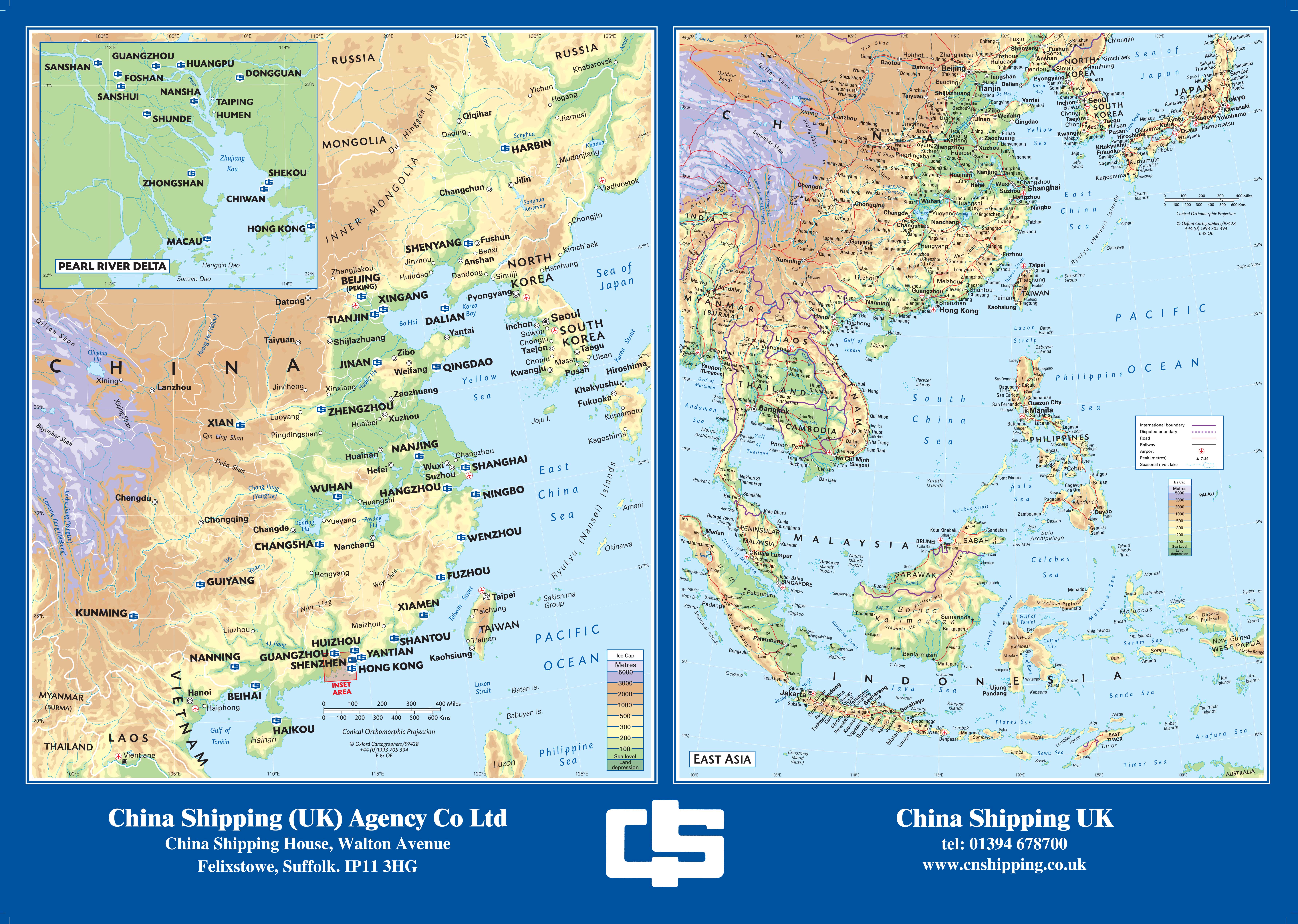
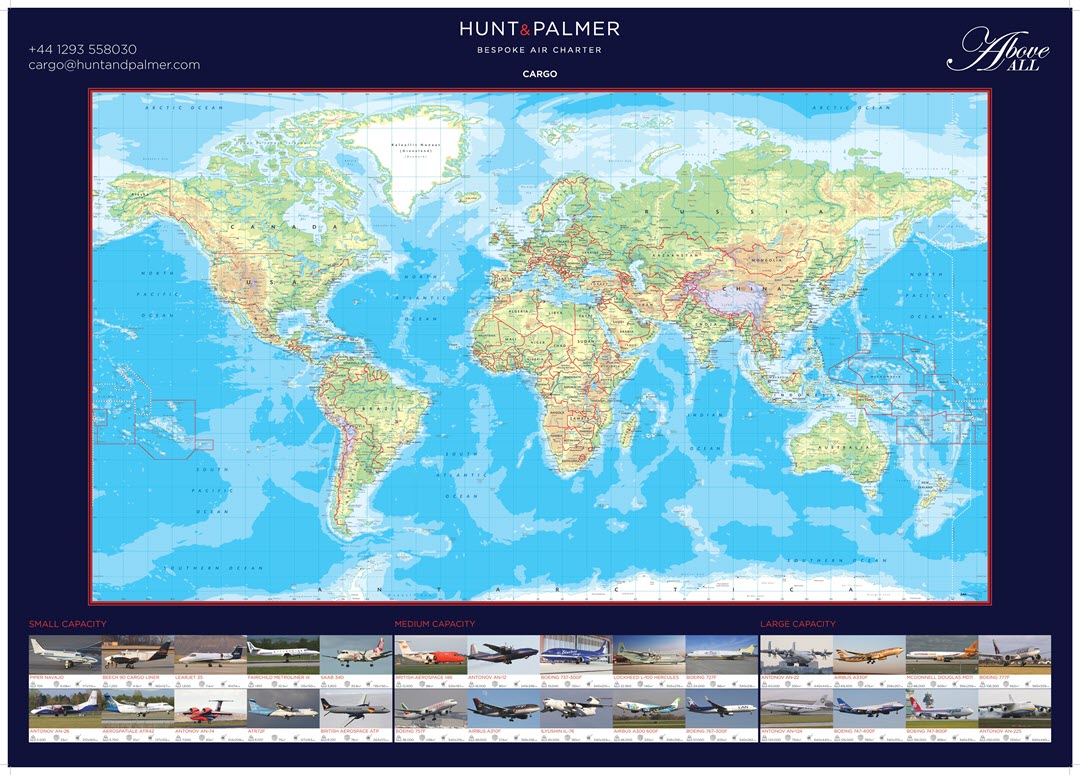
Global and regional mapping can be customised, we can incorporate differing time zones and highlight shipping routes, countries, main destinations and facilities.

Maps can easily be distributed at airports, hotels & tourist information centres allowing guests to easily navigate and experience your local area, adding value to their stay.

Clear, attractive mapping that demonstrates not only the retail environment but also the evening and night economies can help to encourage income from tourism, visitors and leisure.
GET IN TOUCH
To get your questions answered, please leave your details below