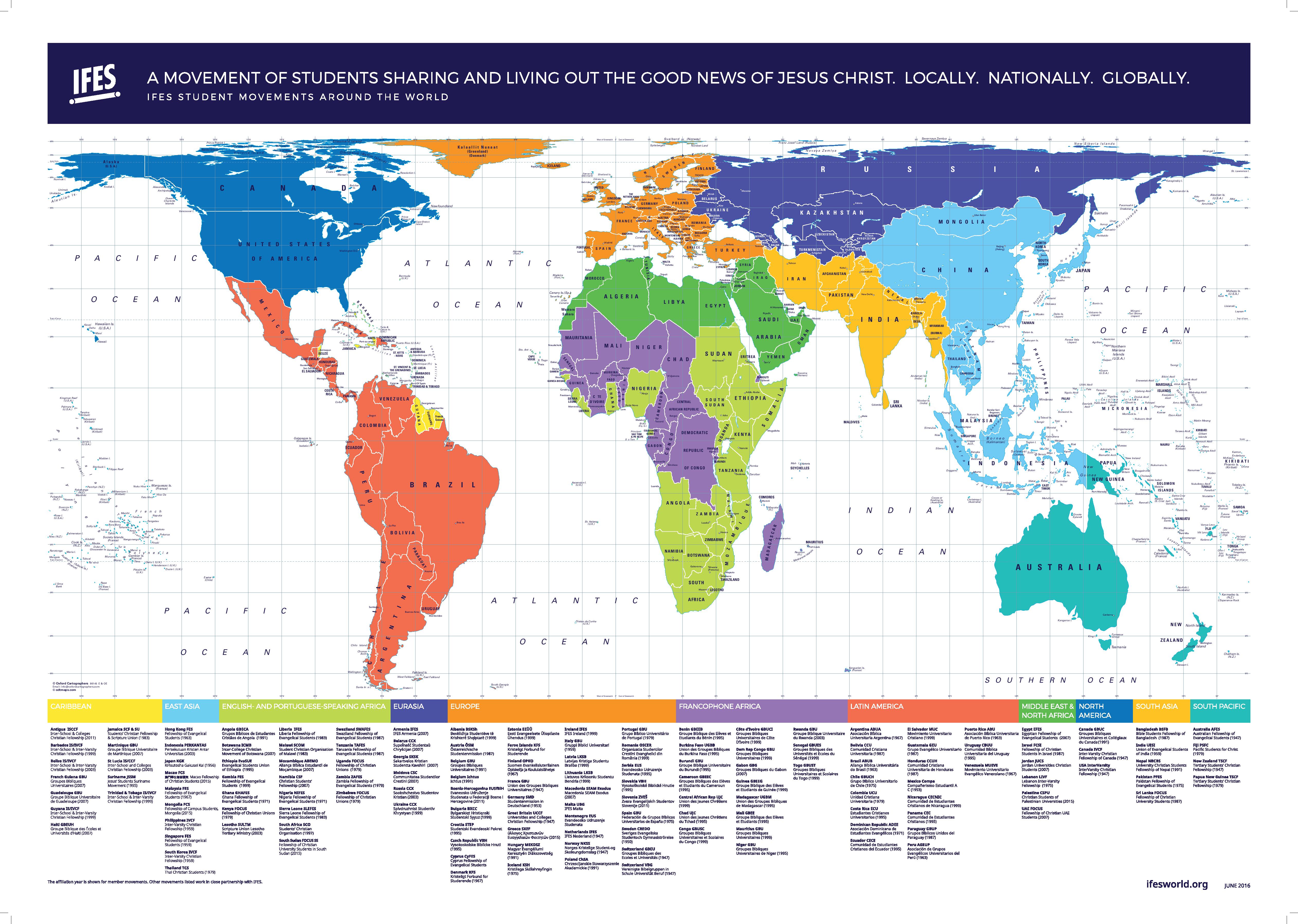
Reshaping Perspectives: The Hobo-Dyer Equal Area Global Maps
In a world where perceptions are often shaped by the maps we use, the Hobo-Dyer Equal Area Global Map emerges as a transformative cartographic innovation. Designed to challenge conventional North-South orientations and provide a more accurate representation of our planet, this map projection offers a fresh perspective on global geography.
Conceived by ODT, Inc., the Hobo-Dyer projection draws inspiration from the Peters equal area concept while minimising distortion of both size and shape of land masses. Its origins can be traced back to modifications of the 1910 Behrmann projection, with the cylinder intersecting the globe at 37½° north and south, a departure from Behrmann’s standard parallels at 30° north and south.
Commissioned in 2002 by Howard Bronstein (Ho) and Bob Abramms (Bo) of ODT, Inc., and expertly drawn by cartographer Mick Dyer of Oxford Cartographers, the Hobo-Dyer Map offers a unique feature: it is printed on both sides, one with the conventional north orientation and the reverse featuring the south on top. This subtle shift encourages viewers to confront biases and question how maps influence their perception of the world.
At the heart of the Hobo-Dyer projection is its equal area property. Land masses are depicted proportionally to their actual sizes on Earth’s surface, providing a more accurate representation of continents and countries. Despite introducing distortion in terms of shape and direction, particularly near the poles, this trade-off ensures an equitable portrayal of our planet’s geography.
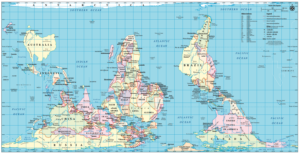
Centred on the Prime Meridian, the Hobo-Dyer projection splits the eastern and western hemispheres along this meridian while attempting to represent the North and South Poles without typical distortions seen in other projections.
One of the most significant aspects of the Hobo-Dyer Map is its social justice dimension. By challenging traditional maps that often exaggerate the size of wealthy, northern countries, this projection aims to provide a more equitable representation of the world. It has been utilised in educational settings to promote a balanced understanding of global geography, emphasising the importance of accurate representation.
The Hobo-Dyer projection gained global attention when President Jimmy Carter utilised it during his Nobel Peace Prize ceremony in 2002 to illustrate his agency’s international efforts. Its unique place in cartographic and geopolitical history highlights its significance in reshaping how we perceive and understand the world.
Oxford Cartographers offers various options including North or South orientation, detailed or simple cartography, and multiple language choices. The Hobo-Dyer Equal Area Projection Map provides versatility for different preferences and purposes. Whether used for educational initiatives, social justice campaigns, or simply gaining a more accurate understanding of our planet, the Hobo-Dyer Map stands as a beacon of innovation in the realm of cartography, offering a more inclusive view of our world.
We offer a range of mapping services to suit every one of your requirements, contact us today to find out more information.