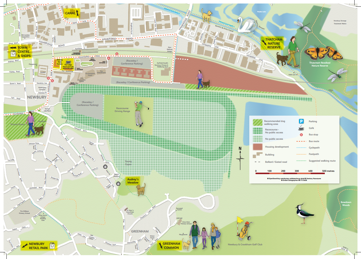
NEWBURY RACE COURSE
Drag or click the diamond to see the front and back of the map
This was a great project to work on to aid community engagement around Newbury Racecourse.
The area around the racecourse has gone through a massive transformation in the last few years, with a new housing development wrapping around the racecourse. This caused a few safety concerns, with the local residents walking dogs, or simply entering restricted areas where large agricultural machinery was in use, or simply the area was very busy because of a race day or wedding.
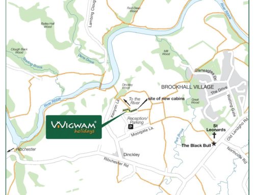
The developers decided to provide a location map designed to help both residents and prospective residents know which areas of the Racecourse estate are available for recreational purposes, as well as provide a handy guide to the surrounding area, whilst trying to keep everybody safe and the Racecourse and surrounding businesses working.
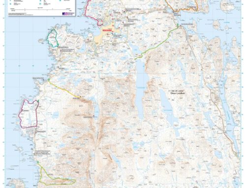
The project call for an A2 folded customised map to show locals where they can and cannot walk their dogs, and also access public footpaths.
In addition other features were also required to help local residents get a feel for what is on their doorstep. The map also needed to show bus routes and proposed bus routes, cycle routes, canal walks, dog walking routes, public rights of way, out of bounds areas and also key features off the map edge with arrows and names.
The map also shows proposed new housing developments, and on the reverse was an opportunity for the local businesses to advertise their services too!
We created a set of 6 illustrations to make the custom map more fun and engaging for the user; so as part of the sales and welcome pack, all the residents now receive the “Welcome to Newbury Racecourse” Location Map helping to make sure that its a vibrant and safe place for all.