Angel.London
Wayfinding Maps: legible london
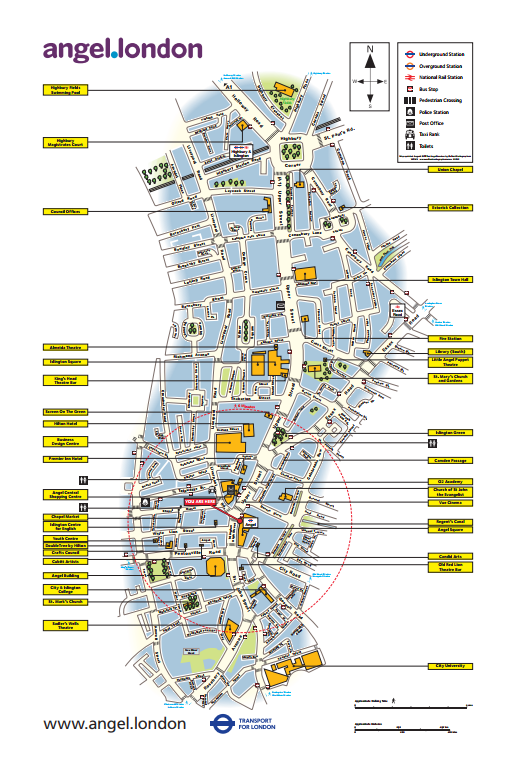
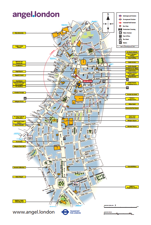
Angel contacted us as they wanted to update their wayfinding maps located in Islington. The maps were originally created in 2007 and required updating with the latest information. The maps were originally created by our sister company FWT.
To future proof the maps to allow for ease of updating in the future, we created the maps in our latest software. (maps were originally done in freehand) this means that the maps can be updated on a regular basis, much more cost effective than having to redraw the whole lot again.
Oxford Cartographers carried out the surveying of the area to ensure complete accuracy. There were 6 locations in total therefore the total solution required 12 maps. This makes sure there is 1 map each side of the lith, 1 facing north, 1 facing south depending on which side of the lith you were looking at (easier for the user of the map to understand accurately where they were).
Using the survey data, and information provided by the customer, we updated the maps, including updating out of date names, highlighting landmarks and key buildings and also removing /inserting yellow places of interest name boxes.
The newly created custom made maps were then passed to customer who had them printed themselves and installed into the liths.
We’re bringing tangible benefits to all our member businesses, and making real improvements at the Angel for everyone who invests, works, lives and visits here. We are proud to be managing one of London’s most unique and increasingly desirable town centres.