
FAREBROTHER MAP
What we did
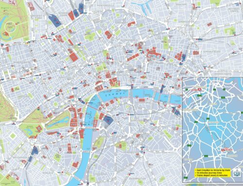
The maps needed to fit to a large area at specific measurements, taking into account features on the wall such as air vents. Selecting our own London base map, two areas were extracted and “life-like” sample maps to scale were sent to the customer to ensure they would be fit for purpose.
The maps were then enhanced with features such as road names, Borough names and boundaries, Crossrail & Thameslink locations, postcode information and building shapes, all as required by the customer.
The design of the maps then focused on a colour scheme that matched with Farebrother’s reception area to ensure continuity and effective brand awareness.
We provided proofs for checking, and tweaked the design as required.
The Result
“We were looking for maps that didn’t look cluttered, but highlighted key features in our two core areas of expertise in Central London – Midtown and with our joint venture company Union Street Partners, the South Bank. Our aim was to have artwork for our boardroom and meeting room walls to provide a feature within the rooms, and also to be used as a practical and accurate tool for business meetings. We are very pleased with the result that Oxford Cartographers have created for us.”
Lizzie Cave
Marketing Manager

Before

After
Leave A Comment
You must be logged in to post a comment.