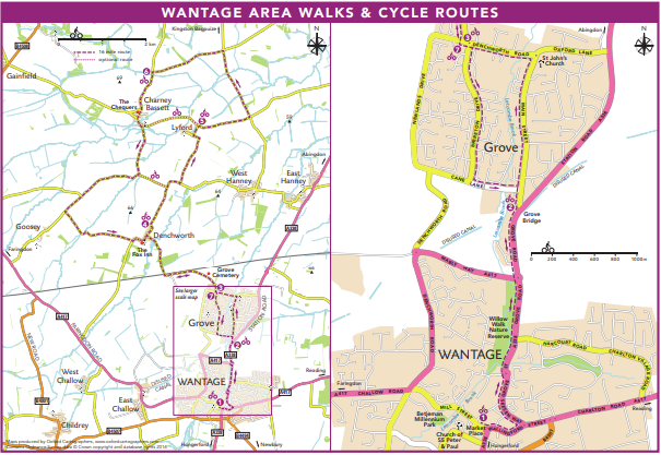
Grove Parish Council Walking and Cycling Maps
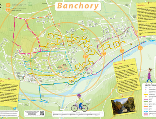
Project aim was to produce up to 18 themed A5 walking and cycling route cards in Wantage and Grove for tourists, commuters and local residents. The first step was for volunteer local walkers and cyclists to identify and prioritise routes along existing public paths where they plotted the route using GPS readings at intervals. Grove employed an outside source to create a voluntary focus group to compile and discuss the best route information. This was conducted over several meetings and route information was collated with GPS markers and route descriptions. We created a template to be common to all maps, to include frames, title, photos and the logos of supporting agencies. Some of the route maps were at different scales, depending on the distance and shape of the routes. For each map we plotted the route (walking, cycling or running) with numbers for the 2-5 key points in the route description and on some maps, in addition to numbered points, we created boxes stating the GPS reference for the key points on the route. These maps were created as print ready PDFs for the council to distribute to relevant departments for tourists, commuters and local residents.
Click on the image below to see the full route card