Autumn Newsletter
Carl Thomas2023-08-29T13:19:19+01:00A geographic information system (cartoGIS) is a system designed to capture, store, manipulate, analyse, manage, and present all types of spatial or geographical data.

A geographic information system (cartoGIS) is a system designed to capture, store, manipulate, analyse, manage, and present all types of spatial or geographical data.
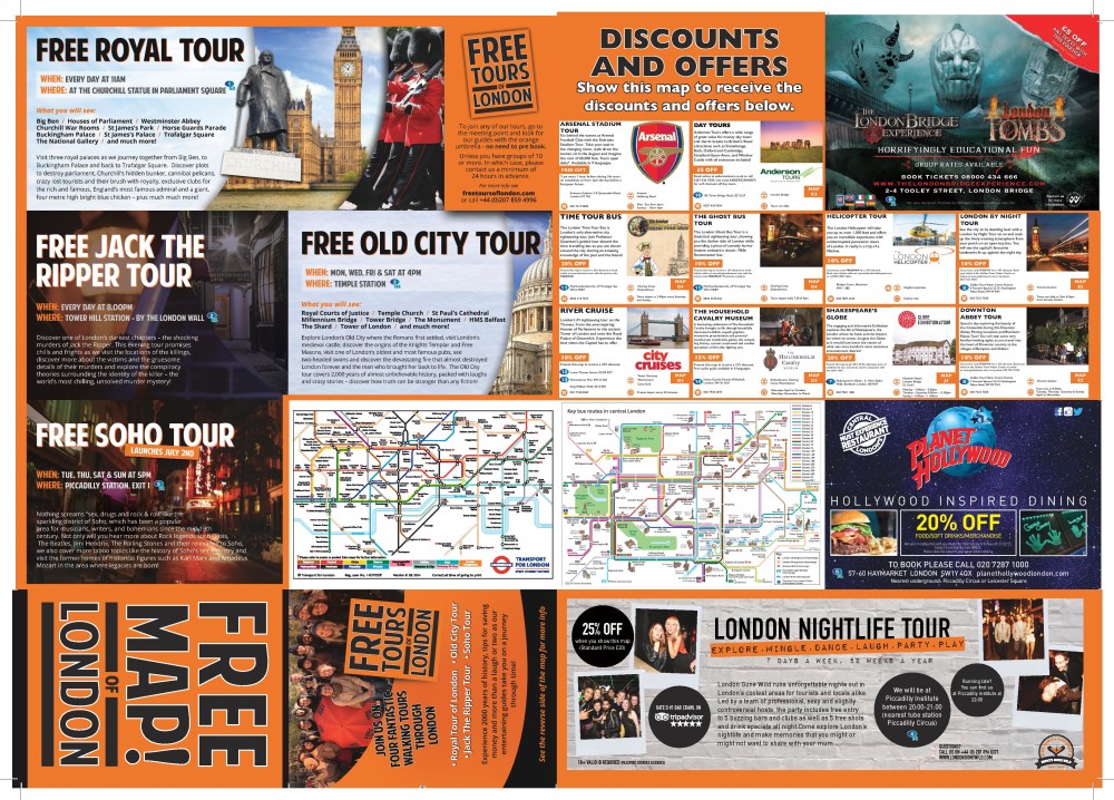
TRAVEL MAPS TESTIMONIAL Travel Maps were not only looking to produce a customized map, but also have the ability to design the map with advertising space on the reverse which would help to fund the project. Oxford [...]
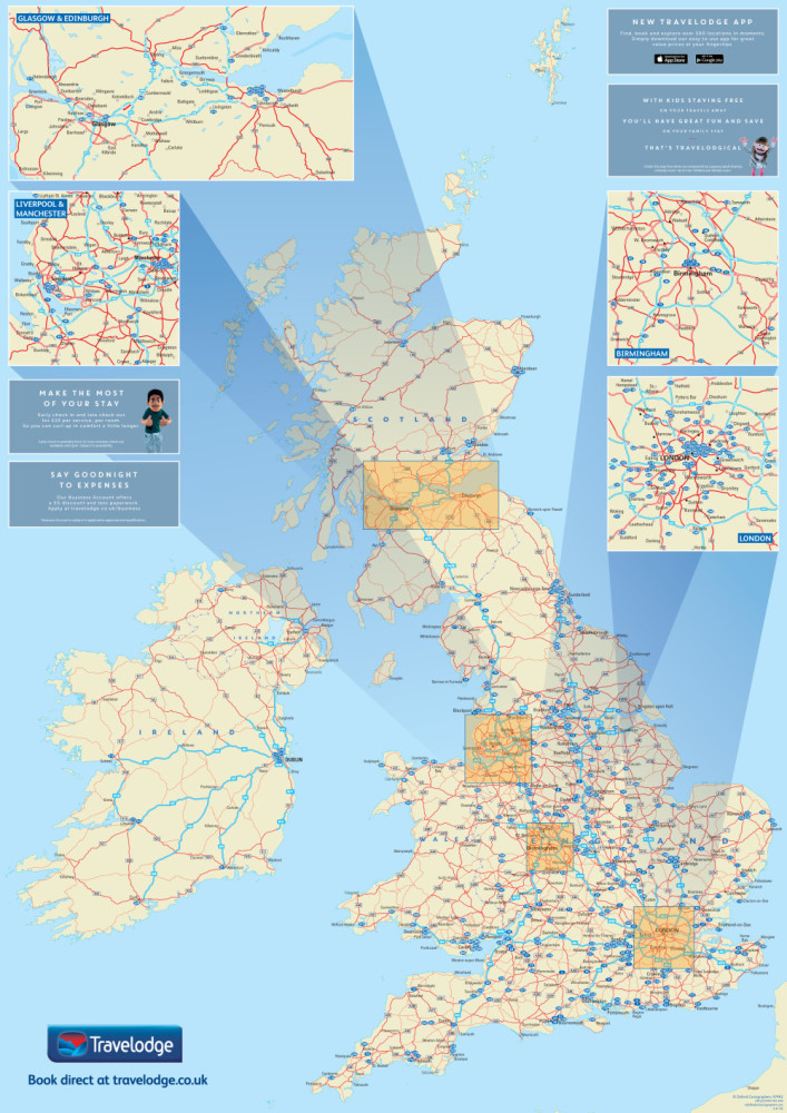
The newly designed customised map needed to include the Travelodge network of over 500 hotels and supplement the nationwide campaign.
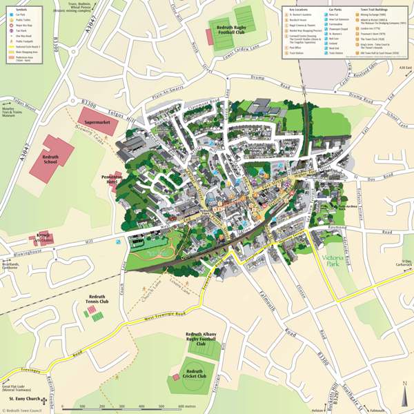
TOWN CENTRE MAPS Town Centre maps often play a crucial part in demonstrating the viability of your town, making it more attractive to potential visitors. Not only can a map show a town centre's desirablity, but can [...]
SUMMER NEWSLETTER 2015 It has been a busy couple of months visiting various shows and exhibitions where we have met new people and have had great business conversations. People often ask me, “what do you do?” and [...]
ACORN SERVICES CASE STUDY - LOCATOR MAP Acorn Services client, The Salvation Army, were hosting a big event in London. They required 15,000 locator maps for their guests. They wanted to customise the map to highlight key [...]
PROMOTIONAL GIFTS THAT LAST A fully branded map with logo, and in the customer's company colour palette Show locations and offices in the UK, Europe or Worldwide Show areas of operation for internal usage Information specific to the customer's [...]
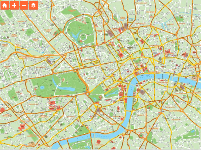
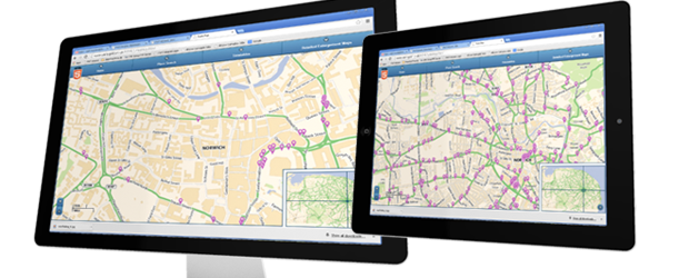
WHAT IS AN INTERACTIVE MAP? Companies with their own websites often seek simple but professional maps to assist their clients in finding their locations and we can provide not just a physical map but also an interactive [...]
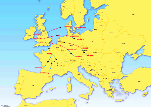
CONGRATULATIONS TO THE MULTIMODAL TEAM ON A VERY SUCCESSFUL 2015 SHOW! Line Haul Maps Help customers understand your reach either in a particular region, country or worldwide. Or why not use the map [...]
Oxford Cartographers provided a simple solution - an end product that was cost effective, with a swift turnaround from order to the finished map